![]() Geology
Geology
|
|
|
|
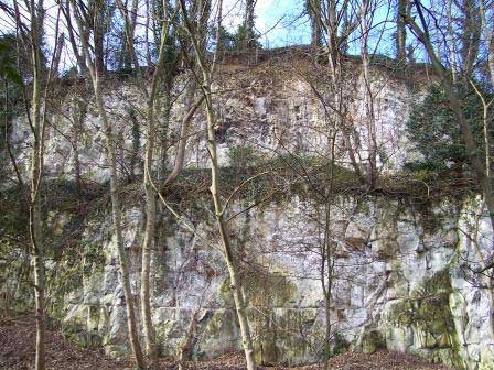
The Yorkshire Wolds solid geology comprise of upper Cretaceous rocks, primarily Chalk, and covers a vast area of England forming the Downs and Wolds as well as the spectacular chalk cliffs at Flamborough Head. The Cretaceous period was between 146 and 65 million years ago and is usually noted for the portion of the “Age of the Dinosaurs” (www.ucmp.berkeley.edu/mesozoic/cretaceous/cretaceous.html).
On sheet 80 of the geology map, 1983, 1:50,000 in file 136 at Hull University the country park area is labelled as Welton chalk and the foreshore as till.
The geology of the northern half of the site is of considerable local importance from a scientific viewpoint. The Hessle Till is considered to typify many of the features of boulder clay in the ‘Humberside’ area. When first scheduled in 1962 (by the then Nature Conservancy Council) it was listed as the best example of Hessle boulder where it rests upon Coombe rock which overlies solid chalk). Unfortunately the horizon on this site has been subjected to heavy weathering which has altered its character.
The site is also of interest because of the "buried cliff", a post-glacial feature which stretches along the eastern edge of the Wolds. This feature is associated with mammalian remains. However, there is a comparable site in better condition at Sewerby Cliff, near Bridlington. English Nature therefore does not consider the site to be of national importance, and has withdrawn its previous status as a Site of Special Scientific Interest (SSSI) (9th January, 1987). However, they have indicated that its status may be upgraded in future if further work was carried out to excavate the deposit and reclassify it if mammalian remains were found (letter dated 17th November, 1986). There is a possibility that the site may be notified as a Regionally Important Geological site (R.I.G.).
Geomorphology/Landform
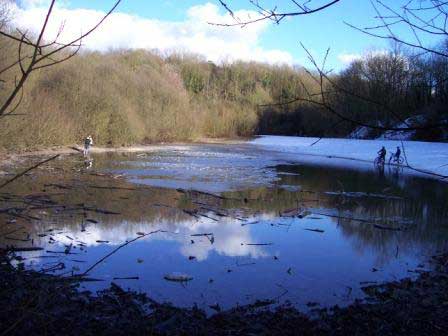
The landform of the country park is a result of its quarrying history and hence exhibits steep terraced chalk cliffs with a flat broad quarry bottom. Surface water is only present at two areas in the lowest points in the quarry floor. In both cases the surface water depends on the height of the water table in relation to lower-lying land.
Soils.
The soils and drainage of the site reflect its geology and topography. The soils vary from vertical chalk cliffs and scree on the steepest slopes to a thick chalky clay in the flatter southern area. In all places the soil is neutral to alkaline. |
Content copyright © 2006 Humber Bridge Country Parkweb design copyright by fohbcp
|